Category:Harling, Norfolk
Jump to navigation
Jump to search

civil parish in Norfolk, UK _-_geograph.org.uk_-_358355.jpg) | |||||
| Upload media | |||||
| Instance of | |||||
|---|---|---|---|---|---|
| Location | Breckland, Norfolk, East of England, England | ||||
| Area |
| ||||
 | |||||
Subcategories
This category has the following 4 subcategories, out of 4 total.
Media in category "Harling, Norfolk"
The following 200 files are in this category, out of 234 total.
(previous page) (next page)-
 A clearing in the making - geograph.org.uk - 1709277.jpg 640 × 480; 167 KB
-
 A much carved-up tree - geograph.org.uk - 1709679.jpg 640 × 480; 176 KB
-

-
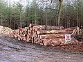 A stack of timber in Big Wood - geograph.org.uk - 1709672.jpg 640 × 480; 172 KB
-
 A1066 Thetford Road ^ entrance to Dolphin Farm - geograph.org.uk - 4991261.jpg 3,072 × 2,227; 3.02 MB
-
 A1066 Thetford Road, Brettenham - geograph.org.uk - 4991246.jpg 3,072 × 2,257; 2.87 MB
-
 Access road to Dower House Touring Park - geograph.org.uk - 1709665.jpg 640 × 480; 157 KB
-

-
 Adventure Centre and Forest Retreat - geograph.org.uk - 6131303.jpg 3,456 × 2,592; 3.86 MB
-
 B1111 Garboldisham Road, Middle Harling - geograph.org.uk - 5024917.jpg 3,072 × 2,304; 1.87 MB
-
 B1111 Harling Road, Middle Harling - geograph.org.uk - 5025102.jpg 3,072 × 2,304; 1.93 MB
-
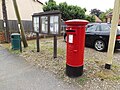
 B1111 Market Square ^ Market Square Postbox - geograph.org.uk - 5016180.jpg 3,072 × 2,304; 1.91 MB
-
 B1111 Market Square ^ Market Square Postbox - geograph.org.uk - 5016182.jpg 3,072 × 2,304; 1.88 MB
-
 B1111 Market Square, East Harling - geograph.org.uk - 5016197.jpg 3,072 × 2,304; 1.71 MB
-
 Beech Trees - geograph.org.uk - 1619176.jpg 640 × 480; 142 KB
-
 Bridge over the River Thet - geograph.org.uk - 1703339.jpg 640 × 466; 160 KB
-
 Bridgham Lane - geograph.org.uk - 2161028.jpg 1,600 × 1,200; 690 KB
-
 Bridgham Lane past West Harling Common - geograph.org.uk - 1710458.jpg 640 × 480; 141 KB
-
 Bridleway - geograph.org.uk - 3136862.jpg 768 × 1,024; 252 KB
-
 By the entrance driveway to Dower House, West Harling - geograph.org.uk - 6131331.jpg 3,456 × 2,592; 3.84 MB
-
 Byway towards Hill Harling - geograph.org.uk - 4601935.jpg 640 × 462; 82 KB
-
 Cemetery - geograph.org.uk - 3137647.jpg 1,024 × 768; 229 KB
-
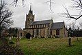 Church of St Peter and St Paul, East Harling - geograph.org.uk - 3815123.jpg 3,872 × 2,592; 3.57 MB
-

-

-
 Cottages - geograph.org.uk - 3136860.jpg 1,024 × 768; 184 KB
-
 Crop field and hedgerow - geograph.org.uk - 4589259.jpg 640 × 480; 51 KB
-
 Crop field off Kenninghall Road - geograph.org.uk - 4589252.jpg 640 × 480; 72 KB
-
 Crop field off Kenninghall Road - geograph.org.uk - 4589272.jpg 640 × 470; 81 KB
-
 Deep muddy ruts - geograph.org.uk - 1709290.jpg 640 × 480; 176 KB
-
 Downhill Plantation - geograph.org.uk - 3136869.jpg 1,024 × 768; 251 KB
-
 Driveway to Stonehouse Farm - geograph.org.uk - 1710488.jpg 640 × 545; 151 KB
-
 East Harling cemetery - geograph.org.uk - 5294560.jpg 3,456 × 2,592; 3.74 MB
-
 East Harling Common - geograph.org.uk - 832237.jpg 427 × 640; 97 KB
-
 East Harling entrance sign - geograph.org.uk - 2282257.jpg 640 × 448; 53 KB
-
 East Harling Fire Station - geograph.org.uk - 4611139.jpg 640 × 480; 56 KB
-
 East Harling in-church War Memorials - geograph.org.uk - 5025482.jpg 2,592 × 3,456; 2.95 MB
-
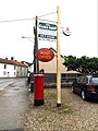
 East Harling Post Office - geograph.org.uk - 4611140.jpg 640 × 480; 70 KB
-
 East Harling Post Office - geograph.org.uk - 5016176.jpg 3,072 × 2,304; 2.09 MB
-
 East Harling Post Office sign ^ Market Square Postbox - geograph.org.uk - 5016193.jpg 2,270 × 3,030; 4.38 MB
-
 East Harling Recreation Ground - geograph.org.uk - 1019504.jpg 3,072 × 2,304; 1.3 MB
-
 East Harling Recreation Ground - geograph.org.uk - 1019513.jpg 3,072 × 2,304; 1.33 MB
-
 East Harling Recreation Ground - geograph.org.uk - 3814249.jpg 3,872 × 2,592; 4.24 MB
-
 East Harling War Memorial - geograph.org.uk - 5025480.jpg 3,456 × 2,592; 3.84 MB
-
 East Harling, St. Peter and St. Pauls' Church - geograph.org.uk - 5793740.jpg 5,108 × 3,409; 3.44 MB
-

-

-

-

-

-

-

-

-

-

-

-

-

-

-

-

-

-

-

-

-

-

-

-

-

-

-

-

-

-

-

-

-

-

-

-

-

-

-
-

-
 East Harling, St. Peter and St. Pauls' Church, The nave - geograph.org.uk - 5793769.jpg 7,174 × 4,787; 5.15 MB
-

-
 Entrance drive to Thorpe Forest - geograph.org.uk - 6131301.jpg 3,456 × 2,592; 3.98 MB
-
 Entrance to The Dower House Touring Park - geograph.org.uk - 5024101.jpg 3,072 × 2,304; 1.89 MB
-

-
 Entrance to Thorpe Adventure Centre ^ footpath - geograph.org.uk - 5022035.jpg 3,072 × 2,304; 1.86 MB
-
 Farm cottage off Quidenham Road - geograph.org.uk - 2249072.jpg 640 × 480; 68 KB
-

-
 Farm track off Kenninghall Road - geograph.org.uk - 4589249.jpg 640 × 480; 71 KB
-

-
 Field beside East Harling Road - geograph.org.uk - 2250008.jpg 640 × 480; 159 KB
-
 Fields on a frosty morning near East Harling - geograph.org.uk - 3805933.jpg 3,872 × 2,592; 4.09 MB
-
 Fire Rendezvous Point 73 on West Harling Road - geograph.org.uk - 6131308.jpg 3,456 × 2,592; 3.94 MB
-

-
 Firebreak on Skewter Plantation - geograph.org.uk - 6131323.jpg 3,456 × 2,592; 3.93 MB
-
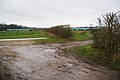
 Flooded area at Fen Lane - geograph.org.uk - 832229.jpg 640 × 427; 142 KB
-
 Footbridge at East Harling Common - geograph.org.uk - 832259.jpg 427 × 640; 102 KB
-
 Footpath Bridge And Stile - geograph.org.uk - 2161034.jpg 1,200 × 1,600; 761 KB
-
 Forest - geograph.org.uk - 2161023.jpg 1,600 × 1,200; 839 KB
-
 Forest Holidays shop and cafe. Thorpe Forest - geograph.org.uk - 5921470.jpg 4,608 × 3,456; 4.77 MB
-
 Forest Road - geograph.org.uk - 2161894.jpg 1,600 × 1,200; 603 KB
-
 Forest Track - geograph.org.uk - 1619145.jpg 640 × 480; 137 KB
-
 Forest Track - geograph.org.uk - 2161027.jpg 1,600 × 1,200; 716 KB
-
 Forest track meets unnamed lane - geograph.org.uk - 1709662.jpg 640 × 480; 156 KB
-
 Garboldisham Road - geograph.org.uk - 3137658.jpg 1,024 × 768; 228 KB
-
 Garboldisham Road cemetery - geograph.org.uk - 3409682.jpg 4,320 × 3,240; 4.31 MB
-
 Garboldisham Road, North Lopham - geograph.org.uk - 4545896.jpg 3,072 × 2,304; 1.71 MB
-
 Giant hogweed along the Peddars Way - geograph.org.uk - 5416016.jpg 800 × 600; 74 KB
-
 Grave marker of SAC R.J. SLATER, RAF - geograph.org.uk - 5025493.jpg 2,592 × 3,456; 3.16 MB
-
 Hanging sign of the George and Dragon - geograph.org.uk - 5294547.jpg 2,592 × 3,456; 2.76 MB
-
 Hanging sign of The Swan at East Harling - geograph.org.uk - 5294541.jpg 2,592 × 3,456; 2.82 MB
-

-
 High water in the River Thet - geograph.org.uk - 1733833.jpg 640 × 480; 141 KB
-
 Home Farm, East Harling - geograph.org.uk - 3820418.jpg 3,872 × 2,592; 5.28 MB
-
 Hop (Humulus Lupulus) on the Peddars Way - geograph.org.uk - 5921439.jpg 4,608 × 3,456; 5.89 MB
-
 Installation off Kenninghall Road - geograph.org.uk - 4601939.jpg 640 × 480; 110 KB
-

-

-
 Kenninghall Road - geograph.org.uk - 3136865.jpg 768 × 1,024; 242 KB
-
 Kenninghall Road - geograph.org.uk - 4589256.jpg 640 × 480; 46 KB
-
 Kenninghall Road - geograph.org.uk - 4589267.jpg 640 × 480; 100 KB
-
 Kenninghall Road - geograph.org.uk - 4601938.jpg 640 × 480; 54 KB
-
 Large scale outdoor pig farming - geograph.org.uk - 5923068.jpg 4,608 × 3,456; 3.46 MB
-
 Leaving East Harling - geograph.org.uk - 4589254.jpg 640 × 480; 91 KB
-
 Leaving The Mapped Area - geograph.org.uk - 2161022.jpg 1,200 × 1,600; 380 KB
-
 Livestock building near Middle Harling - geograph.org.uk - 3820406.jpg 3,690 × 2,460; 1.21 MB
-
 Lodge - geograph.org.uk - 3136852.jpg 1,024 × 768; 197 KB
-
 Man-made pond at East Harling Common - geograph.org.uk - 832266.jpg 640 × 427; 75 KB
-
 Market Square Postbox - geograph.org.uk - 5016189.jpg 2,251 × 3,004; 4.85 MB
-
 Market Square Postbox ^ East Harling Village Notice Board - geograph.org.uk - 5016190.jpg 3,072 × 2,304; 1.79 MB
-
 Market Street, East Harling - geograph.org.uk - 3409699.jpg 4,320 × 3,240; 3.62 MB
-
 Middle Farm - geograph.org.uk - 3136855.jpg 1,024 × 768; 172 KB
-
 Minor Road - geograph.org.uk - 3137630.jpg 1,024 × 768; 193 KB
-

-
 Muntjac at Harling Thorpe - geograph.org.uk - 1852809.jpg 640 × 480; 95 KB
-
 North along the Peddars Way - geograph.org.uk - 5415997.jpg 800 × 578; 196 KB
-
 On Peddars Way - Pigs cooling off N of Blackwater - geograph.org.uk - 6014481.jpg 5,184 × 2,920; 6.33 MB
-
 Ordnance Survey Cut Mark - geograph.org.uk - 4210339.jpg 640 × 480; 124 KB
-
 OS Flush Bracket G1554 East Harling - geograph.org.uk - 1921809.jpg 1,024 × 819; 182 KB
-
 Pasture on West Harling Common - geograph.org.uk - 1710469.jpg 640 × 480; 184 KB
-

-
 Path to Thorpe Woodlands - geograph.org.uk - 1710482.jpg 640 × 480; 156 KB
-
 Peddars Way - geograph.org.uk - 2161876.jpg 1,200 × 1,600; 885 KB
-
 Pig farm next to the Peddars Way - geograph.org.uk - 5416007.jpg 800 × 493; 110 KB
-
 Pig farm next to the Peddars Way - geograph.org.uk - 5416011.jpg 800 × 488; 124 KB
-
 Pig farming off Kenninghall Road - geograph.org.uk - 4589264.jpg 640 × 480; 49 KB
-

-

-

-
 Pig-farming near Middle Harling - geograph.org.uk - 3820411.jpg 3,872 × 2,592; 3.83 MB
-
 Pigs meeting around a muddy wallow - geograph.org.uk - 5923072.jpg 4,608 × 3,456; 4.14 MB
-
 Plane tree beside Bridgham Lane - geograph.org.uk - 1710504.jpg 480 × 640; 213 KB
-
 Plastic Walkway - geograph.org.uk - 2161862.jpg 1,200 × 1,600; 744 KB
-
 Power Lines - geograph.org.uk - 3136867.jpg 769 × 1,024; 166 KB
-
 Public Footpath - geograph.org.uk - 2161024.jpg 1,200 × 1,600; 546 KB
-
-
 River Scene - geograph.org.uk - 2161032.jpg 1,600 × 1,200; 776 KB
-
 River Thet - geograph.org.uk - 1852830.jpg 640 × 480; 82 KB
-
 River Thet - geograph.org.uk - 1852870.jpg 640 × 480; 97 KB
-
 River Thet from footbridge over on Peddars Way - geograph.org.uk - 5921417.jpg 4,608 × 3,456; 6.04 MB
-
 Road into East Harling - geograph.org.uk - 2249042.jpg 640 × 480; 70 KB
-
 Road Junction - geograph.org.uk - 3137638.jpg 1,024 × 768; 214 KB
-
 Road junction on the B1111 - geograph.org.uk - 3062732.jpg 3,648 × 2,736; 2.58 MB
-
 Roadsign on West Harling Road - geograph.org.uk - 5022024.jpg 2,304 × 3,072; 3.56 MB
-
 Roadsign on West Harling Road - geograph.org.uk - 5024120.jpg 2,265 × 3,011; 4.49 MB
-
 Roadsign on West Harling Road - geograph.org.uk - 5024914.jpg 3,072 × 2,304; 1.94 MB
-
 Roadsigns on the B1111 Watton Road - geograph.org.uk - 5016115.jpg 3,072 × 2,304; 1.9 MB
-
 Rotting wood in Thorpe Woodlands - geograph.org.uk - 1710131.jpg 640 × 480; 185 KB
-
 School Lane, East Harling - geograph.org.uk - 3814260.jpg 3,872 × 2,592; 4.33 MB
-
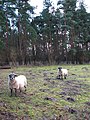
 Sheep with young lambs - geograph.org.uk - 6131458.jpg 3,456 × 2,592; 3.82 MB
-

-
 Sign for the Swan, East Harling - geograph.org.uk - 4589168.jpg 556 × 640; 65 KB
-
 Signpost along the Peddars Way - geograph.org.uk - 5416038.jpg 800 × 549; 194 KB
-
 Small Bridge - geograph.org.uk - 2161031.jpg 1,600 × 1,200; 693 KB
-

-
 Solar Farm at Dolphin Farm - geograph.org.uk - 4993640.jpg 3,072 × 2,304; 1.86 MB
-
 Soul Survivors - geograph.org.uk - 1619158.jpg 640 × 480; 81 KB
-
 Square plantation borehole, West Harling - geograph.org.uk - 6131316.jpg 3,456 × 2,592; 3.88 MB
-
 St George's Distillery - geograph.org.uk - 1441393.jpg 640 × 425; 45 KB
-
 St Peter and St Paul East Harling - geograph.org.uk - 3090922.jpg 1,024 × 768; 227 KB
-
 St. Peter ^ St. Paul, the parish church of East Harling - geograph.org.uk - 2967599.jpg 3,648 × 2,736; 3.23 MB
-
 Telegraph Hill, East Harling Road - geograph.org.uk - 2250013.jpg 640 × 480; 108 KB
-
 The Dower House - geograph.org.uk - 1709685.jpg 640 × 480; 152 KB
-
 The Dower Touring Park sign - geograph.org.uk - 5024097.jpg 3,072 × 2,304; 1.82 MB
-
 The George and Dragon public house at East Harling - geograph.org.uk - 5294544.jpg 3,456 × 2,592; 3.74 MB
-
 The George and Dragon, East Harling - geograph.org.uk - 4609708.jpg 640 × 480; 68 KB
-
 The lane to West Harling - geograph.org.uk - 1709180.jpg 640 × 480; 152 KB
-
 The Old Cinema at East Harling - geograph.org.uk - 5294548.jpg 2,592 × 3,456; 2.93 MB
-
 The Peddars Way at West Harling Belt - geograph.org.uk - 5416042.jpg 800 × 600; 197 KB
-
 The River Thet at East Harling - geograph.org.uk - 3815132.jpg 3,872 × 2,592; 5.12 MB
-
 The Street, Middle Harling - geograph.org.uk - 5025143.jpg 3,072 × 2,304; 1.88 MB
-
 The Street, Middle Harling - geograph.org.uk - 5025148.jpg 3,072 × 2,304; 1.83 MB
-
 The Street, Middle Harling - geograph.org.uk - 5025198.jpg 3,072 × 2,304; 1.92 MB
-
 The Swan public house at East Harling - geograph.org.uk - 5294540.jpg 3,456 × 2,592; 3.76 MB
-
 The Swan, East Harling - geograph.org.uk - 3814257.jpg 3,872 × 2,592; 3.17 MB


_1_-_geograph.org.uk_-_5793817.jpg)
_2_(detail)_-_geograph.org.uk_-_5793824.jpg)
_3_(detail)_-_geograph.org.uk_-_5793828.jpg)
_4_(detail)_-_geograph.org.uk_-_5793831.jpg)
_5_(detail)_-_geograph.org.uk_-_5793833.jpg)


_-_geograph.org.uk_-_5793816.jpg)


_-_geograph.org.uk_-_5793840.jpg)
_-_geograph.org.uk_-_5793842.jpg)
_-_geograph.org.uk_-_5793844.jpg)
_-_geograph.org.uk_-_5793845.jpg)
_-_geograph.org.uk_-_5793846.jpg)
_-_geograph.org.uk_-_5793849.jpg)
_-_geograph.org.uk_-_5793852.jpg)
_-_geograph.org.uk_-_5793854.jpg)


_on_the_Peddars_Way_-_geograph.org.uk_-_5921439.jpg)


